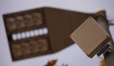
Siemens has installed radar sensors on lampposts along a 200-meter stretch of Berlin's Bundesallee avenue as a trial, transmitting information about parking space occupancy. This sensor network monitors an area of up to 30 meters from above, equivalent to about five to eight parking spaces, and sends information to the parking management software. The traffic information center can then use the collected data for its own information services or forward it, via 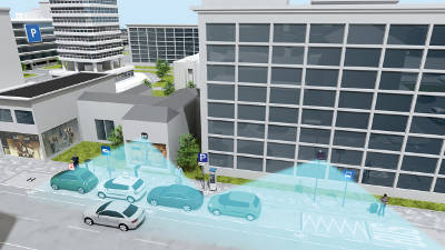 a data interface, to app operators. These apps allow drivers to find available parking spaces using their smartphones, navigation systems, or parking signs.
Predicting where and when parking spaces will be available:
The application, developed by the Robotics Innovation Center at the German Research Center for Artificial Intelligence (DFKI), uses intelligent machine learning methods. Sensor data helps the system recognize typical parking situation. In fact, its learning capability allows the system to predict in advance when and where parking spaces are most likely to be found. The system is also linked to a multimodal route planner. This means that if no spaces are available, the planner provides real-time information on possible public transportation options.
"Our system greatly simplifies the frustrating need to look for parking, as it transmits information about available spaces to the driver before they even leave," explains Jochen Eickholt, Director of the Mobility division at Siemens.
 The project has been funded by the German Federal Ministry for the Environment, Nature Conservation, Building and Nuclear Safety (BMUB) and its main objective is to reduce carbon dioxide emissions, pollutants, and noise associated with road traffic. The results of this trial, which is part of the City2.e 2.0 research project, will be available in 2016.