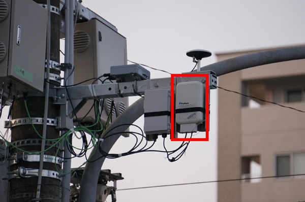
The demonstration was conducted to confirm the effectiveness of the safe driving support system for local bus services through vehicle-to-infrastructure communication using an electric pole and vehicle-to-vehicle communicationwith bicycles at intersections with poor visibility and no traffic lights. This demonstration of safe driving support using an in-service local bus will be the first of its kind in Japan.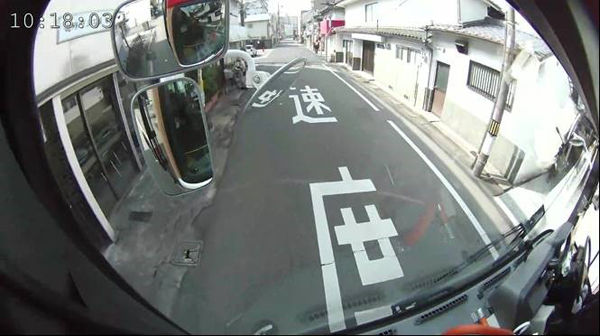
In this demonstration, Fujikura installed a communication device equipped with the module on both utility poles and a local bus to establish a broadband wireless connection between them. Through this wireless connection, the module successfully uploaded real-time images from the vehicle's camera and also transmitted the necessary GNSS (Global Navigation Satellite System) correction datarequired for the high-precision vehicle positioning needed to support safe driving.
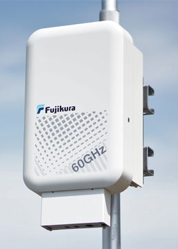 Furthermore, the module, which boasts first-class high-speed communication (>2Gbps) and long-distance transmission capability (>500 m), has also enabled immediate connection for mobile communication. Consequently, studies are being accelerated to apply this technology to various V2X (vehicle-to-everything) systemsgeneral (automated guided vehicles)AGVs used in factories.
With the aim of evaluating this module outdoors, the first users are scheduled to be provided with the "outdoor evaluation kit" which will be used as a communication device for demonstrations starting in the second quarter of 2021. This kit will contain the module and a control processor in an outdoor-ready enclosure and is equipped with a convenient 2×1 Gbps Ethernet network interface.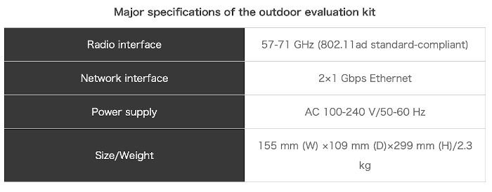
Explanation of Terms
*1 Vehicle-to-Infrastructure Communication: Two-way communication between the vehicle and roadside communication equipment designed to provide various driving assistance features.
*2 Vehicle-to-Vehicle Communication: Two-way communication between vehicles designed to provide various driving assistance features.
*3 GNSS (Global Navigation Satellite System) Correction Data: Positioning data is transmitted to mobile stations via radio or the internet from ground reference stations after the reference stations calculate corrections for errors due to satellite clock drift and ionospheric delay. The result is centimeter-level positioning accuracy.
*4 V2X (Vehicle-to-Everything): Vehicle-to-vehicle communication for exchanging data by interconnecting cars with other cars, people, and networks.
*5 AGV (Automated Guided Vehicle): An unmanned transport vehicle used for industrial purposes.